Canmore Intersection Webcam — Live Downtown Traffic
Webcam at the Downtown Canmore Intersection — Live Traffic Update
The central street of the small mountain town of Canmore sits at the junction of 7th Avenue and 8th Street, historically known as Main Street. This is a major hub for tourists and locals alike, with shops, hotels, and public spaces all packed into a compact area. The transportation infrastructure here reflects the city's environmental priorities, making it pedestrian- and cyclist-friendly.
History of Main Street's Development in Canmore
Originally, Main Street was primarily a residential road with some of the town's oldest buildings, but over time it transformed into the commercial core. The historic name persists in everyday conversation, while the official designation is 8th Street. A significant change came in 2023 with the introduction of a seasonal arrangement: from May 8 through October 11, motor vehicles are temporarily banned on Main Street between 6th and 8th Avenues. This measure is aimed at supporting active recreation and foot traffic during the tourist season.
Pedestrian Zone and Intersection Safety
Canmore's street design places a strong emphasis on pedestrian crossing safety. The intersection at 8th Street and 7th Avenue features refuge islands that separate vehicle and pedestrian flows. The city is actively testing new traffic management concepts, including protected intersections, which reduce the risk of conflict on the roads.
Public Transit in the City
The municipal transit system, now known as Roam, has been operating since 1994 and was rebranded in 2008. Routes connect the downtown core with outlying neighborhoods, including parking areas and transport hubs. Drivers can expect steady movement on surrounding streets, where dedicated corridors have been created for vehicles, while the central zone prioritizes access for residents and visitors.
How to Use the Webcam for Trip Planning
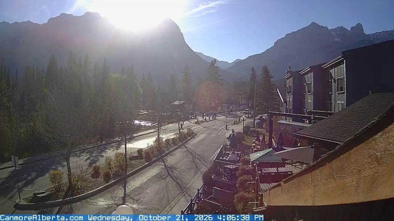
The downtown Canmore intersection webcam lets you check current road conditions before heading out. The camera's placement provides clear views of the intersection and surrounding area from multiple angles. Users can look for congestion, traffic volume, and other factors that might affect travel time. The image quality captures detailed snapshots of both road conditions and public spaces.
Transportation Infrastructure and Surroundings
Immediately adjacent to the camera are pedestrian zones with trees, street furniture, and flower-decorated facades of commercial buildings. In the background, iconic natural landmarks like Mount Rundle and the Three Sisters are visible, giving the area its scenic character. This landscape underscores the city's eco-consciousness and focus on active recreation, which is reflected in urban planning.
What the Camera Shows
The live feed from the downtown Canmore intersection camera displays the pedestrian zone with road markings and safety islands. The frame includes streetlights, traffic signals, benches, and a rest area with a red umbrella. You can see commercial buildings, hotels, and shops with signage, along with flower decorations on facades. Rocky mountains are visible in the background. Pedestrians and cyclists are on the street, confirming the area's status as a primarily people-focused zone.
Similar cameras
Find similar