

🏙️ Webcams Millinocket Online — Watch the City in Real Time
3 cameras

City History: From Paper Mill to the 'Magic City'
The history of Millinocket began in 1897 in Penobscot County, Maine. The town was founded around the production site of the Great Northern Paper Company, which began producing newsprint in the town as early as 1900. Such rapid industrial development transformed a small settlement into an important economic center. The name Millinocket has roots in the Abenaki language and means 'land of many islands,' referring to the abundance of islands in the surrounding lakes, including Millinocket Lake.
The era of industrial prosperity earned the town the nickname 'Magic City', as the population grew rapidly thanks to the success of the world's largest paper mill, built in 1900. The company's founders brought hundreds of Italian immigrant stonemasons and workers. According to the 1900 census, 432 of Millinocket's 1,002 residents were born in Italy, forming the town's unique ethnic structure.
The peak production period fell in the 1970s and 1980s, when Great Northern Paper Company produced 16.4% of all newsprint in the United States. However, in early 2003, the company declared bankruptcy, leading to serious economic difficulties for the town. Today, the town is in the process of economic restructuring.
In 2020, Millinocket's population was 4,114 people. The town maintains a strong industrial and cultural identity shaped by its history and geography.
Why Millinocket Is Called the 'Magic City'
The nickname 'Magic City' stuck to Millinocket thanks to the incredible pace of population growth in the early 20th century. When the paper mill opened in 1900, the town literally sprang into rapid growth, transforming from a small settlement into a major industrial center in just a few years. This dynamic led to the nickname, reflecting the magic of transformation.
Many of the town's historic buildings have survived to this day, reminiscent of its industrial past. Millinocket's architectural appearance is distinguished by a combination of historical industrial structures and modern infrastructure. The town blends organically into the natural landscape of northern Maine, where forests and waters create a unique atmosphere.
For visitors and residents of Millinocket, the surrounding lakes with their many islands hold special significance, further aligning with the meaning of the town's name. These bodies of water serve as a source of inspiration and a place for outdoor recreation, adding a romantic and mysterious touch to the town.
Mount Katahdin — The Heart of Maine
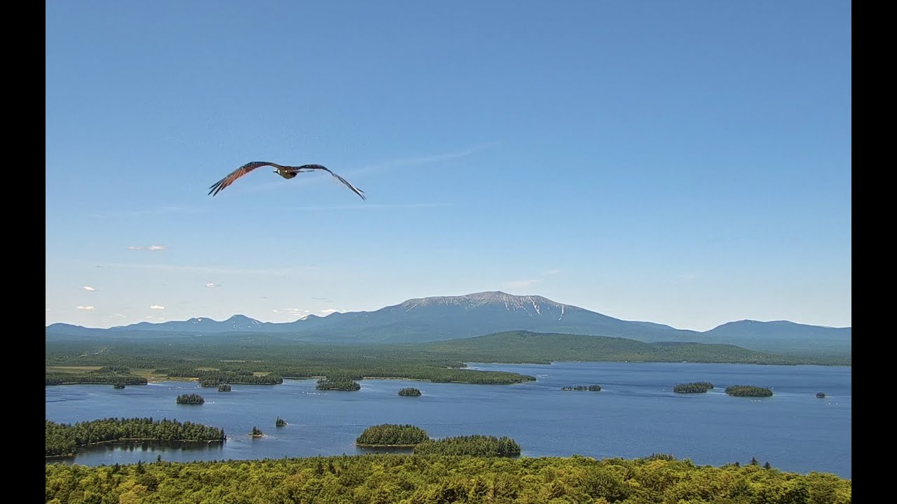
The region's most famous natural landmark — Mount Katahdin — occupies a dominant position in the surrounding landscape. Mount Katahdin is the highest mountain in the state of Maine, with an elevation of 5,269 feet (1,606 meters). In the Penobscot language, the mountain is called 'Katahdin,' meaning 'Great Mountain' or 'Mountain of the Greatest Height'.
Katahdin's geological structure is unique: it is a massive mountain shaped like a horseshoe with five distinct peaks, including Baxter Peak (the highest point at 5,267 feet), Hamlin Peak (4,751 feet), How Peak, South Peak, and Pamola Peak. The length of the sharp Knife Edge ridge at the summit is about 1.4 km, making it one of the most challenging and thrilling trails in North America.
To the north, Katahdin is the terminus of the Appalachian National Scenic Trail, which stretches southwest through the entire Appalachian range to Georgia. Hundreds of hikers complete this route each year to place the final mark on their journey's map.
Mount Katahdin holds deep sacred significance for the Penobscot, Maliseet, Mi'kmaq, Passamaquoddy, and Penobscot Native American tribes. The mountain's geology is central to their oral traditions and cultural practices, reflecting the inseparable connection of these peoples with this natural landmark.
The mountain's safety history records more than 60 fatalities since the first registered tragedy in Baxter State Park in 1933. Unpredictable weather conditions at altitude require travelers to exercise special caution and preparation. Approximately 60,000 people visit Baxter State Park annually, making Katahdin one of the most popular and simultaneously demanding destinations in the United States.
Baxter State Park: Pristine Nature
The natural complex of Baxter State Park, created and maintained by a million dollars donated by President Theodore Roosevelt to the town of Millinocket, preserves 209,501 acres of virgin wilderness in its untouched state. The park was founded as a protected area that today serves as a model for conserving unique forest and mountain ecosystems.
In recent years, the number of visitors to Baxter State Park has changed: if in 2000 there were about 75,000, then in 2005 the number dropped to 55,000. However, starting in 2005, the number of visitors began to grow slowly, indicating sustained interest in this natural treasure.
Baxter State Park offers diverse outdoor recreation opportunities, including hiking trails of varying difficulty, rock climbing, cross-country skiing, and wildlife observation. The park's territory stretches across thousands of acres of forest and mountain peaks, creating an ideal contrast with urban Millinocket.
Lakes and Islands Around Millinocket
The lakes surrounding Millinocket play a key role in the town's life, creating conditions for various types of recreation. Millinocket Lake and other regional water bodies are dotted with dozens of islands, reflected in the ethnic origin of the town's name — 'land of many islands'.
The water in Maine's lakes and rivers is distinguished by its clarity and transparency, making them ideal for water-based activities. In the Millinocket area, SUP boarding, fishing, canoeing and kayaking, as well as river surfing on fast-flowing rivers are available.
The Penobscot River, flowing near the town, serves as an important artery for the local economy and recreation. Its waters are rich in fish and are home to numerous waterfowl. The surrounding forests also provide habitat for deer, beavers, and other wildlife.
Ice seasons transform water bodies into ideal trails for cross-country skiing and snowmobiling, which is part of Millinocket's winter heritage. These activities shape the town's unique rhythm of life, alternating the tranquility of forests and rivers with the intense dynamics of winter competitions.
What to Explore in Maine: Routes and Trails
Millinocket's geographic location makes it an ideal base for exploring Maine's natural attractions. Around the town, there are 64 routes in the Millinocket area for hiking, cycling, and running, offered by the AllTrails platform.
Walks through the forests around the town allow visitors to become acquainted with the unique flora and fauna of New England. Many routes run along the shores of lakes, streams, and rivers, providing breathtaking views of nature and various aquatic species. For experienced travelers, routes through mountain ridges and forest arrays with multiple overnight stays are available.
The North Woods of Maine cover a vast area, connecting with Baxter State Park and other protected areas. This network of routes offers the opportunity to explore pristine forests, rivers, and landscapes, creating a unique experience for those interested in nature.
In the summer months, routes along the forest floor and forest trails leading to waterfalls and ponds are popular. Winter months offer winter sports activities, including snowmobiling and snowboarding.
Spring and autumn bring a special atmosphere due to changing leaf colors and the blooming of various plants. These seasons are ideal for hikers and cyclists who enjoy observing natural processes.
Why Millinocket Is the Best Base for Katahdin
The town of Millinocket occupies a key geographic position as the main gateway to Mount Katahdin and Baxter State Park. The distance between Millinocket and Bangor is about 120 kilometers, making the town a convenient entry point for tourists wishing to visit the region's attractions.
Thanks to its developed tourism infrastructure, Millinocket offers guests guide services, accommodations, dining, and transportation, simplifying preparation for climbing Katahdin. The town has good roads leading to Baxter State Park and trailhead starting points.
In Millinocket, you can find necessary goods and services, including gear, consultations, guides, and transportation. These services make the town an attractive base for exploring the region. Additionally, the town provides access to cultural and historical attractions related to its industrial past.
For those interested in mountains, Millinocket becomes a starting point from which to begin the ascent of Katahdin or conduct a series of routes in the mountains of Maine. This position makes the town a key center for nature tourism.
Climate and When to Visit
Millinocket's climate is characterized by sharp changes depending on season and altitude. The summer months — July and August — are the peak time to visit the region. Despite the significant number of tourists, this period offers the best conditions for hiking, with less rainfall and higher air temperatures.
Early autumn months (September) bring pleasant weather and picturesque fall foliage, making it another attractive time to visit. During this time, the number of people on the trails decreases, making hikes more comfortable.
Winter months in Millinocket are short and harsh, yet they offer unique opportunities for winter recreation. Snowy months make the town a hub for winter sports, including snowmobile rides, ice fishing, and ski routes.
In spring and early summer, hikes through forests and rivers can be difficult due to snowmelt and river flooding. Nevertheless, this spring brings special beauty to the region's nature, revitalizing the landscapes.
It is always important to consider the weather forecast when planning hikes, as conditions at altitude can differ significantly from expectations. Planning a trip with weather conditions in mind will maximize the effectiveness of your visit.
What the Cameras Show in the City
This page features live webcams of Millinocket. You can watch street webcams of the town and observe its life around the clock. The cameras are located in the central part of Millinocket, on Main Street, allowing you to assess the town's atmosphere from different vantage points. Additionally, some webcams broadcast views of Millinocket Lake and the Penobscot River, providing opportunities to observe the region's natural features. To see other directions and capture moments of interest, select the desired camera on the catalog page.