

🏙️ Webcams Cranbrook online — watch the city in real time
2 cameras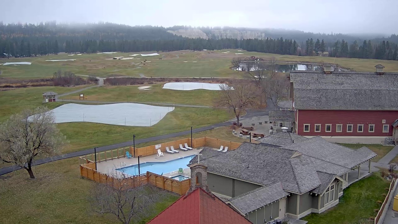
History of Cranbrook: from railway hub to gateway to the Rocky Mountains
Cranbrook is a city whose birth is inseparably linked to the railway. In 1898, Canadian Pacific Railway ran the Crowsnest Pass line through it, and this decision shaped the settlement's fate for centuries to come. Unlike neighboring Fort Steele, which experienced a gold rush, Cranbrook became the administrative and transportation hub of the entire East Kootenay region. Today it is the region's largest urban center with a population of 20,047 people, where railway heritage is carefully preserved in museums and the urban landscape.
The city is located on the west bank of the Kootenay River, approximately 10 kilometers from where it meets the St. Mary River. This geographic position has made Cranbrook a natural gateway for travelers heading to the ski resorts of Fernie and Kimberley, as well as Kootenay and Glacier national parks. The railway theme is evident everywhere here — from the historic depot to museum exhibits.
Geography and climate: a sunny city in the valley
Cranbrook occupies a unique position in the Rocky Mountain system. The city stretches across a valley at an elevation of 905 to 983 meters above sea level, nestled between the Purcell Mountains to the west and the Rocky Mountains to the east. This geography creates a special microclimate — significantly drier and sunnier than in neighboring mountain communities. According to Environment and Climate Change Canada, Cranbrook receives approximately 2,190.5 hours of sunshine per year — more than any other city in British Columbia.
The climate is classified as humid continental (Dfb on the Köppen scale): winters are cold and snowy, but not as harsh as in the prairies, summers are warm and comfortable. Average July temperatures reach +26°C, while in January they drop to −10°C. Precipitation is relatively evenly distributed, with a slight peak in June. These conditions make the city attractive for year-round visits — winter offers skiing, while summer brings hiking trails and water activities on the Kootenay River.
Attractions: railway heritage museum and more
Cranbrook's main cultural gem is the Cranbrook History Centre, formerly the Canadian Museum of Rail Travel. The museum is housed in an original 1898 freight depot and holds North America's largest collection of early Canadian passenger cars. Here you can see luxury trains from the era of transcontinental travel, including cars that ran on the Ottawa — Vancouver route in the early 20th century. The exhibition tells not only about technology but also about people — engineers, conductors, passengers for whom the train was the primary way to cross the continent.
Beyond the railway museum, Cranbrook is home to the Kootenay Gallery of Art, where local artists' exhibitions and performances take place. The city center is adorned by pedestrian-friendly Baker Street — the main artery with historic buildings, cafés, and shops. In summer, life here buzzes until late evening, and in winter the street is transformed by festive lighting.
City districts: where life happens
Cranbrook is a compact city, and most districts are connected by a convenient network of bike paths and walking trails. The central district concentrates administrative buildings, restaurants, and cultural institutions. North of the center are residential neighborhoods with private housing, many offering views of the surrounding mountains. Southern districts are closer to the airport and industrial zone, while eastern ones lead to the Kootenay River and nature trails.
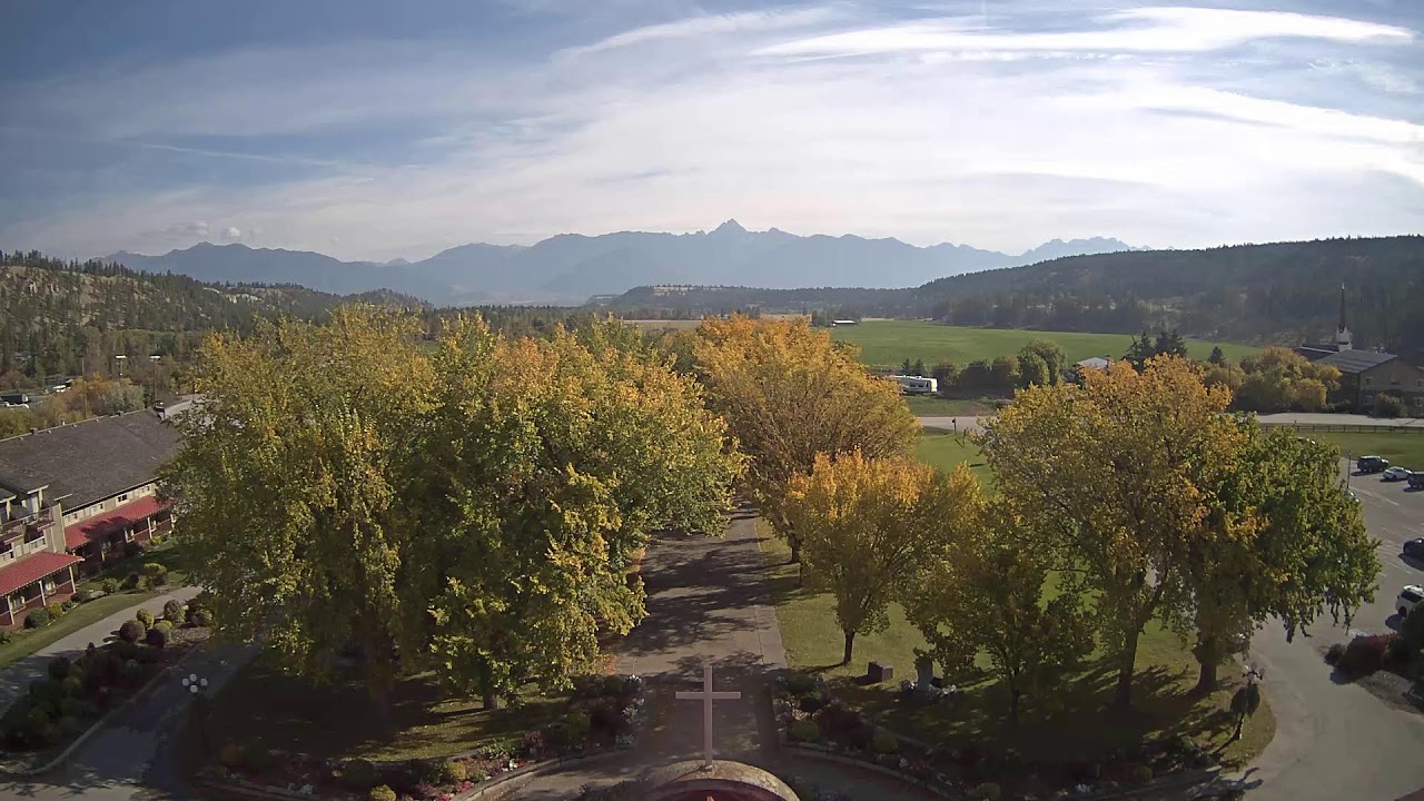
Particular attention deserves the St. Eugene district — a former Catholic missionary complex turned golf resort. This place combines historical architecture with modern comfort and is one of the most prestigious addresses in the city. Webcams available in this area often show mountain landscapes and green golf courses against the backdrop of mountain ranges.
Natural surroundings: mountains, lakes, and parks
Cranbrook serves as an ideal base for exploring the nature of East Kootenay. A 30-minute drive east lies Kootenay National Park with its Radium Hot Springs and canyons. To the west stretches the Kimberley ski resort, and further still is the famous Fernie with world-class runs. The city itself is surrounded by a network of hiking and biking trails, including a path along the Kootenay River, which is especially picturesque in autumn when larches turn golden.
The region's lakes are an attraction in their own right. St. Mary Lake, located nearby, attracts fishing and water sports enthusiasts. However, it's worth noting that direct online streams from this lake are not publicly available — the nearest webcams are located in Cranbrook itself and its immediate surroundings. To monitor weather conditions in the mountains, tourists often use cameras at ski resorts in neighboring towns.
What the cameras show in the city
Cranbrook's webcams cover key points of the city and its infrastructure. The city's official website provides a livestream of city events and council meetings, allowing you to follow Cranbrook's public life in real time. For monitoring road conditions, a camera operates at the intersection of Highway 3/95 and 9th Avenue S, showing the northeast direction — an important junction for transit traffic between Calgary and Vancouver.
Canadian Rockies International Airport provides access to a runway surveillance camera, which is especially valuable for travelers tracking flights and aviation enthusiasts. St. Eugene Golf Resort broadcasts mountain views in HD quality, showing weather conditions in the foothills of the Rocky Mountains. It's worth noting that railway webcams are not available in Cranbrook — rail monitoring services do not cover this section of the Canadian transcontinental railway.