

🏙️ Smøla Webcams Online — Watch Norwegian Island in Real Time
1 cameras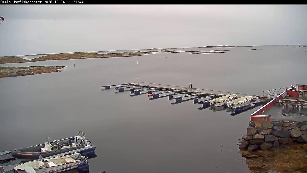
The Island Called the Edge of the Earth
Smøla is not just a point on the map of Norway. Many researchers believe this island to be the legendary land of Thule (Ultima Thule), first described by the Greek traveler Pytheas of Massalia in the 4th century BC. For the ancient world, Thule was the limit of the known world — a land where the ocean meets the sky, and in summer the night lasts only a couple of hours. Today, Smøla webcams allow you to see this edge of the earth as ancient sailors saw it — harsh, windswept, and incredibly beautiful.
Located between Kristiansund and Trondheim on the edge of the Atlantic Ocean, the island of Smøla is described as a "nature paradise" with picturesque fishing villages. This is a place where time flows differently — by the rhythm of tides and the schedule of fishing boats, not by the hands of a clock.
The Landscape of a Thousand Islands
The island of Smøla amazes with its flat lowland landscape, which contrasts with the common perception of Norway as a land of mountains and fjords. Here, thousands of islets and skerries are scattered across the sea surface, creating a labyrinth where it's easy to get lost — and easy to find peace. The dense population of white-tailed eagles makes these places a true paradise for ornithologists and wildlife photographers. These majestic birds with a wingspan of up to two meters nest on coastal cliffs and hunt fish in coastal waters.
The Smøla archipelago is a world where the sea determines everything. Tides change the appearance of the coastline several times a day, exposing sandbars and flooding passages between islands. The wind here is a constant companion, and it is what has shaped the unique character of this place.
Haugjegla Lighthouse: Guardian of the Skerries
On a small skerry, about one kilometer north of Veiholmen, stands one of Norway's most recognizable lighthouses — Haugjegla. Its 28-meter round cylindrical iron tower, painted red with a white stripe, has become a symbol of the island. The first light at this site was established back in 1905, and the current tower was built in 1922. In 1988, the station was automated, and the last keeper left the island.
The lighthouse stands on a wave-washed rock — in a storm, water spray flies above the top of the tower. This is one of the most exposed places on the coast, where the Atlantic shows its temper in full force. Smøla webcams aimed at the lighthouse allow you to observe this confrontation between steel and the elements in real time.
Wind Farm: New Energy of Ancient Land
Southeast of the village of Dyrnes, on the island of Smøla, lies one of Norway's largest wind farms. 68 turbines cover an area of 18 square kilometers and have a maximum capacity of 150 MW, providing an average annual output of 450 GWh of electricity. This is enough for tens of thousands of homes.
The wind farm was built in two phases: the first stage of 20 turbines of 2.0 MW was opened on September 5, 2002, and the second — 48 turbines of 2.3 MW — in September 2005. The facility is operated by Statkraft, one of the largest producers of renewable energy in Europe.
However, the appearance of the wind turbines did not go unnoticed by local nature. Studies have shown that the wind farm has affected the nesting sites of the red-throated diver (Gavia stellata), making part of the territory unsuitable for breeding these birds. This is a classic example of how green energy requires compromises with wildlife.
Veiholmen: The Bacalao Capital
Veiholmen is not just a village, but the largest active fishing village south of the Arctic Circle. About 300 residents are engaged in fish processing, which is used to prepare the famous Norwegian delicacy — bacalao (dried cod). This dish has a long history and remains an important part of the region's culinary tradition.
The village is located on tiny islets connected by bridges and causeways. Colorful fishing houses stand right on the water, and the docks are filled with boats and nets. There is no hustle and bustle of a big city here — only the rhythm of the sea and the smell of salt. Smøla webcams installed in Veiholmen show this atmosphere of authentic Norwegian fishing life.
Deep-Sea Fishing and World Records
Between the islands of Smøla and Hitra lie deep-sea fishing spots known among fishermen throughout Scandinavia. Here they catch ling — the sea pike, which can reach impressive sizes. The world record for ling fishing was set right in these waters — a fish weighing 46 kg was caught. This is truly a prehistoric predator that inhabits the depths and comes out to hunt in the dark.
For fishing enthusiasts, Smøla is a place of pilgrimage. Local fishing centers offer equipment and experienced guides who know every underwater hill and current. And those who prefer to watch from the sidelines can view the fishing boats in the harbor through the island's webcams.
Climate and Best Time for Observation
The climate on Smøla is maritime, with mild winters and cool summers for these latitudes. The Gulf Stream makes the weather here less harsh than one might expect at the 63rd parallel. However, wind is a constant factor that shapes both the weather and the character of the local residents.
In summer, the island experiences white nights — the sun dips below the horizon for only a few hours, and twilight lasts all night. This is the ideal time for observing nature through webcams — you can see both sunset and sunrise in one broadcast. In winter, the northern lights can occur here, although due to the island climate, the sky is often overcast.
How to Get There and What to Bring
You can reach Smøla by car via the road through causeways and bridges that connect the island to the mainland. From Kristiansund, the drive takes about two hours, from Trondheim about three and a half. An alternative is the ferry, which connects the island to the mainland and carries passengers and cars.
For a trip to Smøla, warm waterproof clothing and sturdy footwear are essential — even in summer, the weather can change in minutes. A camera with a telephoto lens will be useful for photographing eagles and landscapes, and binoculars — for observing seabirds and whales that sometimes appear in coastal waters.
What the Cameras Show
On this page, we have collected Smøla webcams that broadcast views of the island in real time. You can watch the Haugjegla lighthouse, the fishing harbor of Veiholmen, the wind farm, and coastal landscapes of the archipelago. The broadcasts are available free of charge and without registration — choose the location that interests you and enjoy the view of the legendary land of Thule without leaving home.
Smøla webcams are a window into a world where ancient legends meet modern technology, where wind turbines turn on that very edge of the earth that Pytheas described two and a half thousand years ago. Watch the Norwegian archipelago live and feel the breath of the Atlantic.