Bogatyrsky and Tourist Intersection in Saint Petersburg — Online Webcam
Intersection of Two Major Roads in the Primorsky District
This live webcam is installed at the intersection of Bogatyrsky Prospekt and Tourist Street — one of the key transport hubs in the Primorsky district of Saint Petersburg. From here, you get a panoramic view of a residential neighborhood where the history of a former airfield, modern development, and green spaces of one of the city's most environmentally favorable districts intertwine.
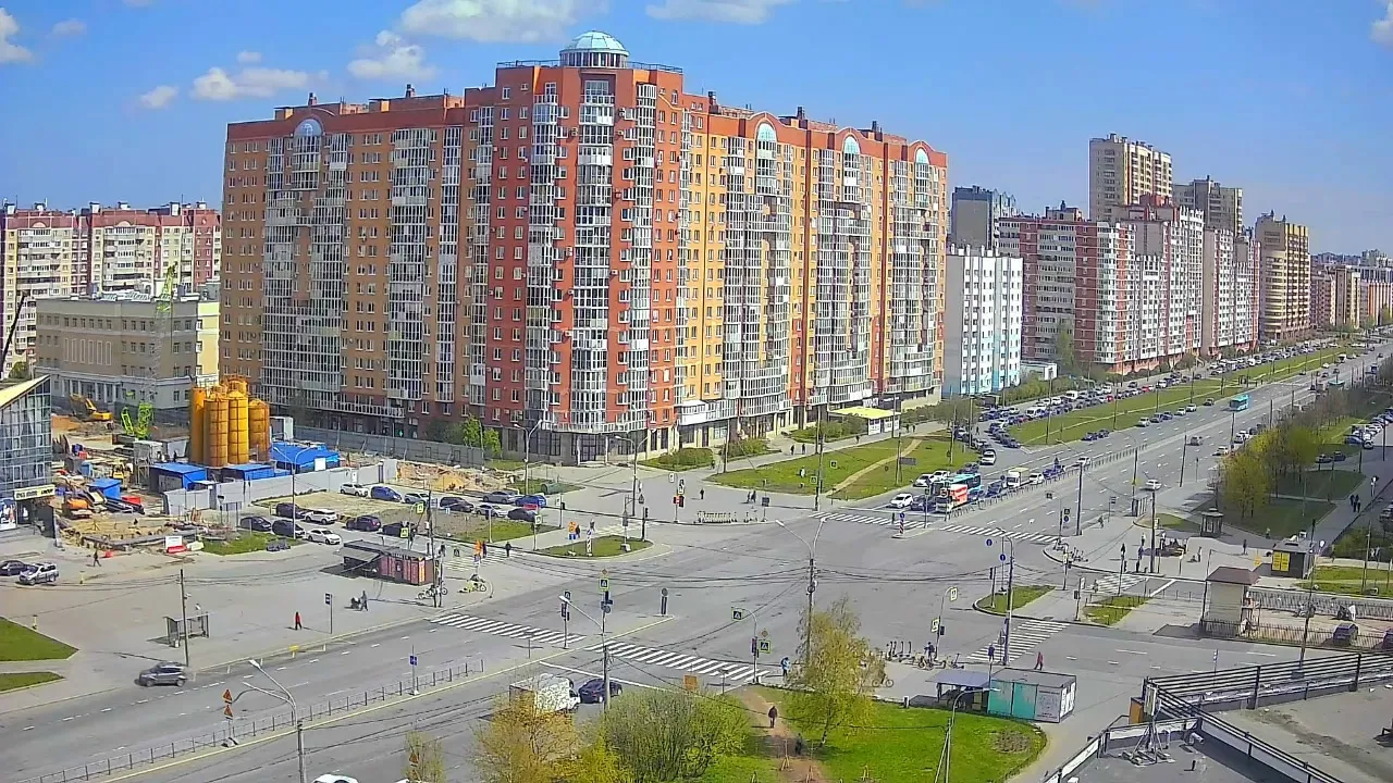
The camera in real time captures a multi-lane road with crosswalks, traffic lights, and road markings. In the frame — cars, buses, cyclists, and pedestrians who pass through this busy intersection every day.
Bogatyrsky Prospekt: From Airfield to Major Thoroughfare
The name of Bogatyrsky Prospekt is directly linked to the history of Russian aviation — the first multi-engine aircraft "Ilya Muromets" and "Russian Knight," which in the early 20th century were called "bogatyrs" in aviation terminology. The avenue was laid out in the 1970s–90s on the territory of the former Komendantsky Airfield.
Initially, the avenue only reached Sizov Prospekt. On March 9, 1987, it was extended to Planernaya Street, and the final section was opened in 2013. Today, Bogatyrsky Prospekt is part of the Central Arc Thoroughfare and one of the main transport arteries of northwestern Saint Petersburg.
Tourist Street: The Sporting Spirit of the District
Tourist Street got its name thanks to the tourist and sports theme of the district. In the same year, neighboring streets were given names related to sports: Begovaya (Running) and Yahtennaya (Yachting). This was due to the proximity to Yelagin and Krestovsky Islands, where major sports facilities are located.
The street is located in the Primorsky district of Saint Petersburg and is divided by the Saint Petersburg—Sestroretsk railway line into two sections: from Primorsky Prospekt to Shkolnaya Street and from Mebelnaya Street to Kamyshevaya Street.
Yuntolovsky Nature Reserve: The Green Heart of the District
The Primorsky district is rightfully considered one of the most environmentally favorable in Saint Petersburg. Its main treasure is the Yuntolovsky State Nature Reserve of Regional Significance. This is the city's first specially protected natural area, covering 1010.81 hectares.
The reserve was created to preserve valuable natural complexes of the eastern Gulf of Finland coastline. Since 2021, an eco-trail has been operating here, and plans include building over a kilometer of wooden boardwalks for walking and cycling. In winter, the reserve becomes a popular ski trail.
Development and Urban Growth
The Primorsky district in northwestern Saint Petersburg features diverse architecture: from Soviet-era panel buildings to modern residential complexes and low-rise cottages. Part of the area is called "Komendantskaya Dacha" — it was tied to the position of the airfield commandant.
The district is rich in green spaces: the 300th Anniversary of Saint Petersburg Park, Udelny Park, Yuntolovsky Nature Reserve, and the Gulf of Finland coastline. Major highways pass through the area, including the Ring Road. A new street is being built that will connect Primorsky Prospekt near the Lakhtinsky Razliv with Bogatyrsky Prospekt.
What Else to See in the Area
Besides the Yuntolovsky Nature Reserve, in the Primorsky district it's worth checking out the 300th Anniversary of Saint Petersburg Park, Udelny Park — one of the city's largest parks, the Glukharka River, and the Gulf of Finland coastline. A historical site is the Komendantsky Airfield, through whose territory Bogatyrsky Prospekt now runs.
The district continues to actively develop: new residential neighborhoods are emerging, road infrastructure is expanding, and embankments and recreational areas are being improved.
What You Can See on the Camera
The live camera broadcasts the intersection of Bogatyrsky Prospekt and Tourist Street in the Primorsky district of Saint Petersburg. In the foreground — a large intersection of major roads with crosswalks, traffic lights, road signs, and markings. Cars, buses, cyclists, and pedestrians are constantly moving through the frame.
In the center of the frame stands a large red-brick residential building with balconies, arched facade elements, and a decorative dome on the roof. In the background — a row of multi-story residential buildings of varying heights. On the left, a construction site with machinery is visible. Around — green lawns, trees, sidewalks, and parking areas. The road with several lanes and a median strip stretches into the distance.
Similar cameras
Find similar